This story originally appeared on SmarterTravel.
Hiking is the most democratic of American pastimes: Almost everyone can do it, and there's no special equipment necessary. All you need is a pair of sturdy, comfortable shoes and a spirit of discovery. And it's an activity that can be enjoyed nearly year-round, by young and old.
Here are 10 of the best day hikes in the country that don't require an Olympian level of fitness, but will still reward you with incomparable scenery and the satisfaction that comes from a great day on the trail.
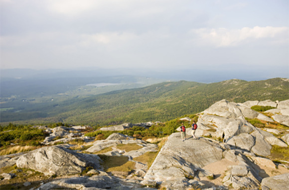
Mt. Monadnock, Jaffrey, NH
- Length: 4.5 miles out-and-back
- Rating: Moderately strenuous
Follow in the footsteps of two of the biggest fans of Mt. Monadnock: Ralph Waldo Emerson and Henry David Thoreau, who both wrote about Monadnock and spent considerable time there. In the meantime, it has become one of the most-hiked mountains in the country.
There are five main trails that lead to the summit of Mt. Monadnock, where you’re rewarded with views that extend for nearly 100 miles in all directions over six New England States. The Dublin Trail is the best bet for avoiding some of the steeper sections found on the other trails.
Related Link: Hiking the High Peaks of New Hampshire’s White Mountains
Rubicon Trail, Lake Tahoe, CA
- Length: 8 miles out-and-back
- Rating: Easy
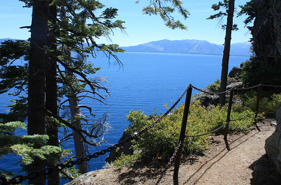
The Rubicon Trail is one of the most popular hikes in and around Lake Tahoe, and for good reason. This mostly level trail more or less hugs the coastline, offering magnificent views of the aptly named Emerald Bay and Fannette Island (Tahoe’s only island) and the other side of the lake, known as “the jewel of the Sierra.”
The hike starts at the parking lot at Vikingsholm, a Scandanivian-design mansion built in 1929 now open for tours May-September. The trail continues four miles to the parking lot at Rubicon Point; pack a snack to enjoy on the beach — and a refreshing swim — before heading back.
You Might Also Like: The Top Hotels in Lake Tahoe
Pihea Trail, Kaui, HI
- Length: 8 miles out-and-back
- Rating: Moderately strenuous
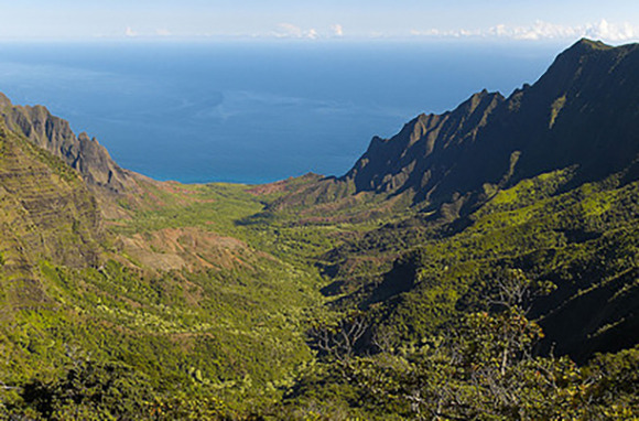
It’s best to hit the Pihea Trail in the morning, because foggy afternoons are common, and you don’t want to be denied the payoff to this hike: spectacular panoramic views of the Na Pali Coast, Hanalei Bay, Princeville, and even the Kilauea Lighthouse on a really clear day.
The Pihea Trail starts at the Pu’u o Kila overlook at Koke’e State Park, with views 4,000 feet down into the Kalalau Valley, as well as back inland to the Alakai swamp (the highest-elevation swamp in the world) and Mount Waialeale, known as “The Wettest Spot on Earth.” A section of the hike is on a boardwalk that keeps you just above the bogs before finally reaching the Kilohana Lookout and its expansive vistas.
Related Link: 10 Best Things to Do in Hawaii
Shortoff Mountain, Linville, NC
- Length: 10 miles out-and-back
- Rating: Moderately strenuous
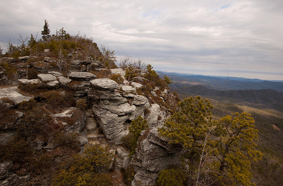
Even though the Shortoff Mountain trail is somewhat strenuous—it’s hard to find one in the Appalachian Mountains that doesn’t have a steep section or two — it’s only rugged for the first couple of miles or so. Then the path becomes relatively flat, leading to the sheer cliffs at the top of Shortoff Mountain.
From there you’ll enjoy unobstructed views of deep, dramatic Linville Gorge, where the river tumbles out of the mountains and onto the Piedmont at Lake James to the south, or look westward to the Pisgah National Forest and Blue Ridge Mountains beyond.
Have You Been to Any of the World’s Top Spots for Fall Foliage?
Pincushion Mountain, Grand Marais, MN
- Length: 4-mile loop
- Rating: Moderately strenuous
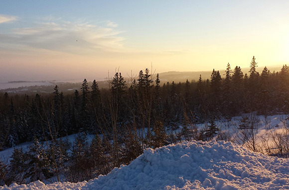
Looking down from atop Pincushion Mountain, you’re seeing the same view of Lake Superior that French fur traders saw more than 300 years ago.
But these days you’ll also take in the Devil Track River Gorge and the town of Grand Marais (one of the gateways to the Boundary Waters Canoe Area Wilderness), including its historic harbor and lighthouse. This trail, a spur off of the larger Superior Hiking Trail, is also a well-used cross-country skiing outing in winter.
Related Link: 7 Epic Walking Trails Around the World
Raspberry Mountain, Divide, CO
- Length: 6 miles out-and-back
- Rating: Moderately easy
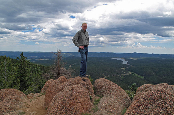
You can have your pick of mountains in Colorado, but Raspberry Mountain can’t be beat for requiring relatively little effort for such a big payoff: stellar 360-degree views of nearby Pike’s Peak, the Tenmile/Mosquito Range (part of the Rockies), the Sawatch Range, the town of Divide, and the Catamount reservoirs.
The wide path is generously shaded by aspen and spruce trees, which makes it particularly comfortable in the hot summer months. And maybe best of all, it’s a dog-friendly trail, which can be tough to find in most national forests.
Pinnacle Peak, Scottsdale, AZ
- Length: 3.5 miles out-and-back
- Rating: Moderately easy
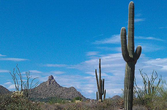
Pinnacle Peak may not be quite as well known as its southern neighbor Camel Peak, but the hike isn’t quite as steep, either, and the views out over Paradise Valley, Scottsdale, the Sonoran Desert, and the mountains in the distance are just as rewarding.
Summers are blisteringly hot, so it’s best to save this one for the late fall, winter, and early spring months, when temperatures dip comfortably. Pinnacle Park is home to a variety of desert wildlife, including coyotes, javelinas, mountain lions, bobcats and mule deer; the best time to catch a glimpse is very early morning or at dusk.
Related Link: Grand Canyon: Secrets of the South Rim and Phantom Ranch
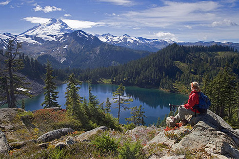
Harry's Ridge, Mount St. Helens, WA
- Length: 8 miles out-and-back
- Rating: Moderately easy
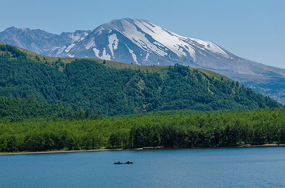
Named for the near-legendary Harry Truman, who famously refused to evacuate his lodge in the days before Mount St. Helens erupted in 1980, this is the most-hiked trail in the area, with panoramic views in all directions, including south to the sometimes still-smoking caldera of Mount St. Helens.
As you gently descend, icy-blue Spirit Lake is directly below, with its huge raft of logs—trees that were toppled in the blast and have been preserved by the cold water. Beyond the lake you’ll see the snow-capped Mt. Adams, and on a clear day, Mt. Hood in Oregon.
You’ll Want to Travel by Rail Since These Amtrak Routes Are So Beautiful
Panther Creek Falls, Clarksville, GA
- Length: 7.2 miles out-and-back
- Rating: Moderately easy
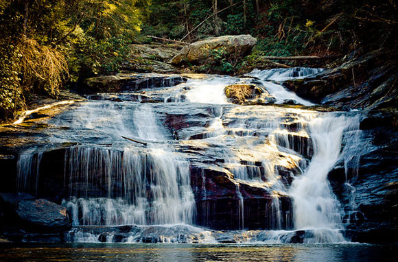
The Panther Creek Falls hike, in Georgia’s Cohutta Mountains, is relatively easy, but does require vigilance at times when scrambling over some of the rocks. But you’ll have plenty of company, as this is a well-loved trail and particularly pretty in fall, when the leaves begin to change color.
The first mile follows what was once a railroad line, before you begin climbing through a boulder field along the creek, eventually reaching the base of the falls and a pretty little swimming hole. Back on the trail, you’ll climb to the top of Panther Creek Falls to find a commanding view of the Conasauga River Valley.
Related Link: 10 Best New Guided Adventure Travel Trips of 2015
Avalanche Lake, Glacier National Park, MT
- Length: 4.5 miles out-and-back
- Rating: Easy
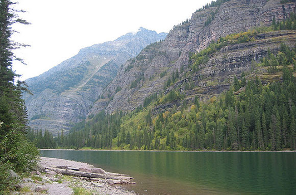
The trail to Avalanche Lake is one of the most popular hikes at Glacier National Park, and an easily accessed introduction to one of our most ruggedly beautiful national parks.
The first section is along Trail of the Cedars, a boardwalk shaded by magnificent old-growth cedars and hemlocks. Before reaching the lake, there’s a short but lovely hike along Avalanche Creek and then a commanding view of Logan’s Pass that was created when an avalanche took out the trees on Mt. Cannon.
Before long you’ll reach your final destination: pristine, glacial-fed Avalanche Lake, surrounded on three sides by waterfalls that cascade down steep cliffs.
- Over 80 Amazing Hotels in South Beach
- The Weirdest Places in the World You Can Spend the Night
- Hotels with Adorable Pet Residents
More from Smarter Travel:
- Patagonia and Torres del Paine: Hiking at the Edge of the World
- The Pennine Way: An Epic Walk on the Wild Side of England
- Walking the Great Wall of China: A Bucket List Trip You Can Actually Afford
Deb Hopewell likes to hike in flip-flops but doesn’t necessarily recommend it. You can follower her on Instagram @debhopewell and Twitter @dhopewell.
All products are independently selected by our writers and editors. If you buy something through our links, Oyster may earn an affiliate commission.


